All that certain lot, piece or parcel of land situate, lying and being in the Town of Spring Bank, in the County of Rocky View, and Province of Alberta, more particularly described as follows:
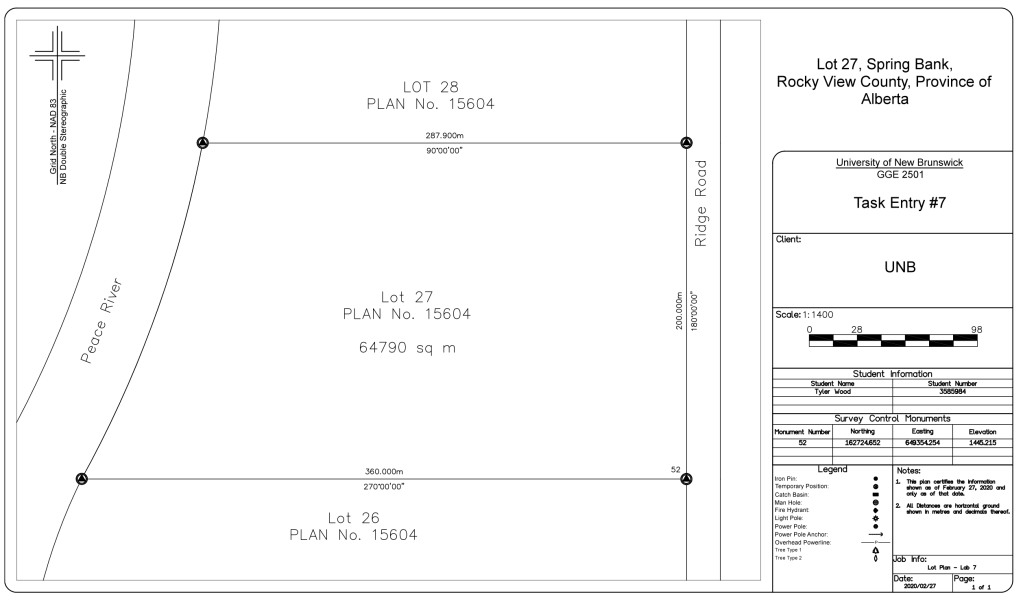
Beginning at a standard iron pin No. 52, on the western side of Ridge Road and being the northeastern corner of Lot 26 of Rocky View County Registry Plan No. 15604, having ATS coordinates 649354.254E, 162724.652; thence westerly along the northern sideline of Lot 26 of Rocky View County Registry Plan No. 15604 on a azimuth of 270 degrees 0 minutes 0 seconds a distance of 360.000 meters or to a point intersecting the high water mark of the eastern sideline of the Peace River, thence northerly along the aforesaid sideline a distance of 212 meters or until intersecting the southern sideline of Lot 28 of Rocky View County Registry Plan No. 15604; thence easterly along the aforesaid sideline on an azimuth of 90 degrees 0 minutes 0 seconds a distance of 287.900m or until intersecting the western sideline of Ridge Road; thence southerly along the aforesaid sideline on an azimuth of 180 degrees 0 minutes 0 seconds a distance of 200.000m or to the point of beginning.
The hereinbefore described parcel containing 64790 square meters. The hereinbefore parcel being a portion of lot 27 of Rocky View County Registry Plan No. 15604.
 GGE 2501 Land Administration Blog